Pollutant emission estimation
We combine field measurements with sophisticated modeling tools to characterize pollutant emissions from various sources, particularly motor-vehicles, from local to regional scale.
Project: Ozone Contingency Plans for Central Florida. MetroPlan Orlando

30 m resolution isoprene emission factor map for continental US
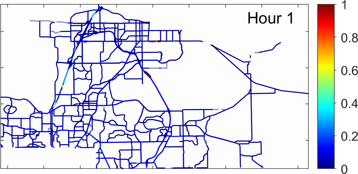
Roadway-link level NOx emissions in Seminole county, FL
(>7500 links shown)

Annual average PM2.5 concentration field as simulated by 14 different methods, including the simple central monitor, aerosol optical depth, dispersion model (RLINE), chemical transport model (CMAQ), and hybrid data fusion techniques
Air quality modeling
We uses both empirical and mechanistic air quality models to simulate the spatiotemporal distributions of air pollutants concentrations, and how the concentrations respond to variations in emissions
Project: Developing Air Pollution Concentration Fields using Alternative Methods for Epidemiological Studies. Electric Power Research Institute
Air pollution measurements
We design and deploy smart and low-cost air quality sensor network to measurement pollutant concentrations in the ambient environment.
We manage the Smart and Trustworthy AIR quality network (STAIR) for Orlando region (http://www.stairnetwork.org/)
Project: A Secure, Trustworthy, and Reliable Air Quality Monitoring System for Smart and Connected Communities. National Science Foundation


Our Smart and Trustworthy AIR quality network (STAIR) installed at one homeowner's house
Mobile measurement using low-cost sensor attached to UCF campus shuttle
Field measurement using our own custom-designed, solar-powered mobile lab

Exposure and health impact estimation
We use big data and smart phone technologies to better understand individual movements in space and time, and use these data to improve air pollution exposure estimation for epidemiological studies.
Project: Framework for Collecting and Updating Time-Activity Patterns. California Air Resources Board
CMAQ simulated pollutant concentrations (background) VS exposures estimated for over 9,000 individuals using their cell phone location data (CDR) , plotted at their corresponding home locations (inlaid circles)